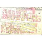
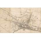
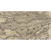
Map details Evaluate precision Bad Ok Good
Map details Evaluate precision Bad Ok Good
Map details Evaluate precision Bad Ok Good
Map details Evaluate precision Bad Ok Good
717-719 Lusignan rue
Building year: 1885
Arrondissement: - Ville-Marie
City: Montréal
Floor height (above ground): 3
Building usage: Logement
Histograd local id: 1127779
Creation date: 2020-04-28 13:24:14 Modification date: 2023-04-18
Sunday School of St. George Church
Cette école fut démolie pour laisser place à la construction de l'Hôtel Laurentien, lui aussi maintenant disparu
Terminus d'autobus de la rue Drummond
Le site du terminus d'autobus de la rue Drummond est maintenant utilisé par un des plus grands gratte-ciel de Montréal, Le 1250 René-Lévesque Ouest!
1539-1551 rue Notre-Dame O
Dans les années 60 il y avait un bar à cet endroit. Quel en était le nom ?
1539-1551 rue Notre-Dame O
En 1961, il y avait la taverne Rousseau Leo, mais quelques années plus tard en 1967, le local était vacant.
Au 1551 Notre-Dame ouest il y avait le Victory Bar 1539-1551 rue Notre-Dame O
Au 1551 Notre-Dame ouest il y avait le Victory Bar
This page have been seen 587 times.
Historical score:135
Localisation: Montréal, MTL, YUL, Québec, Canada
* We do our best to get the best accuracy, but in some maps it's hard to go beyond 20m.
Name this place
Add keywords
Add to a list
To find former residents of this place, visit the directory Lovell
Person or institution related
717-719 Lusignan rue, preset view, feel free to change it
This place has an historical interest?
Historic Ressources
To find out who lived in this house in the last century search in this historic street index.
Lovell Street Index
Discussions
Non. Toutes les photos identifient l'édifice de la Tooke, aujourd'hui identifié comme l'éduifice ELPRO. L'étoile est bien positionnée.


Add a comment or ask a question